
Pacific Coast Highway by RV: What the Route Looks Like Beyond the Postcard
Senior RVers eyeing California's coast should know about narrow roads, steep grades, and which stretches suit larger rigs and mobility needs.
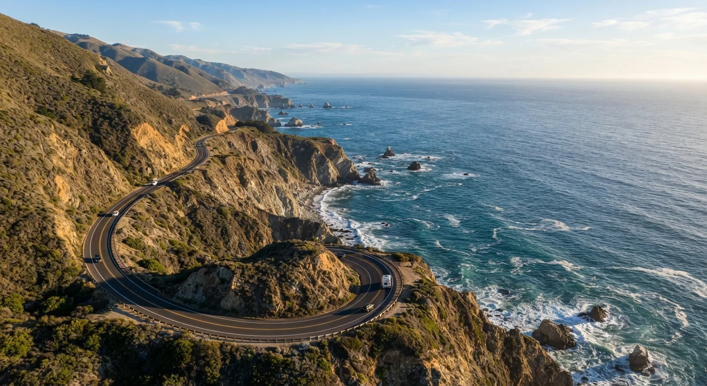
Photo: MyUrbanEscapes.net | Small Escapes. Big Experiences. editorial
—— In This Article
Key Takeaways
- Many PCH sections have low clearances, sharp curves, and pullouts too small for rigs over 25 feet.
- Several accessible, amenity-rich overnight stops along the coast suit larger RVs and mobility needs well.
- Advance campground reservations are essential — walk-up sites on the California coast fill months ahead.
- Fuel stations are sparse between certain stretches; planning fill-ups carefully prevents stressful situations.
- Splitting the drive into shorter daily segments reduces fatigue and allows more enjoyment of the scenery.
The Dream vs. The Drive
California's Pacific Coast Highway — officially State Route 1 — ranks among the most photographed roads in America. For senior RVers, the appeal is obvious: ocean vistas, redwood groves, quaint harbor towns, and a sense of journey that few routes can match. But the postcard version glosses over steep grades, one-lane bridges, and tunnels with strict height restrictions that can catch drivers off guard.
This doesn't mean the PCH is off-limits. It means preparation separates a stressful trip from a truly memorable one. Understanding what the road actually demands — and which segments genuinely welcome larger rigs — lets you plan with confidence rather than wishful thinking. See our complete RV trip planning roadmap before locking in your route.
Myth
The entire Pacific Coast Highway is suitable for any size RV — it's a major California state route, after all.
Fact
Several segments, especially through Big Sur, have posted length restrictions and low-clearance tunnels that exclude rigs over 35 feet.
Route 1 is indeed a state highway, but large sections were engineered long before modern motorhomes existed. The Pfeiffer Canyon Bridge area and multiple tunnels between Carmel and San Simeon have posted height restrictions as low as 13'6". Class A motorhomes and fifth-wheels over 35 feet are advised to avoid the Big Sur core entirely, and Caltrans periodically closes segments for storm damage repairs. Always check current advisories at the California Department of Transportation website before your trip.
Myth
You can find a campsite along the PCH anytime — California has plenty of state parks.
Fact
Coastal California campgrounds, particularly between Malibu and Mendocino, book out months in advance, especially from May through September.
California's state park reservation system opens bookings on a rolling six-month window, and sites at popular coastal parks like San Simeon, Pfeiffer Big Sur, and Morro Bay frequently fill within hours of becoming available. Walk-up availability is unreliable and cannot be planned around. Senior travelers benefit most from booking at least three to four months ahead and identifying a secondary site as a backup. Private RV parks near coastal towns tend to have more availability but verify hookup types and rig-length limits before reserving.
Myth
Driving the PCH is straightforward because the ocean is always on one side — you can't get lost.
Fact
Navigation along Route 1 is more complex than it appears, with mandatory inland detours, frequent construction reroutes, and unreliable cell service in key stretches.
Portions of Route 1 through Big Sur have been closed and rerouted onto US-101 for extended periods due to landslides and bridge repairs — sometimes with little advance notice. Cell service drops out for long stretches between Carmel and Cambria, making GPS-dependent navigation unreliable. Carrying a current paper map or a downloaded offline map on a tablet is a practical precaution, not just a quaint habit. A physical atlas of California covers all the alternate routes you may need.
Myth
The PCH is flat coastal driving — grades and curves aren't an issue for most RVs.
Fact
The Big Sur segment includes sustained grades of 7–9% and tight switchbacks that demand low gear, strong brakes, and an experienced driver.
The Santa Lucia Mountains drop directly into the ocean along Big Sur, which means Route 1 climbs and descends repeatedly across steep terrain. Grades of 7–9% are common, and some corners have recommended speeds as low as 15 mph. For RVers towing a vehicle or driving a heavier Class A, these grades require careful brake management to avoid overheating. If your rig has a tow-haul mode or engine braking, use it. Drivers who haven't navigated mountain grades with a large vehicle should practice on less-traveled roads first — see insights experienced RVers wish they'd known earlier.
Myth
Accessibility features for travelers with limited mobility are rare along the PCH.
Fact
Several key towns and parks along the route offer accessible paths, beach wheelchairs, and level campsite options — but they require advance research to locate.
Morro Bay State Park, Pismo Beach, and the Monterey area have invested in accessible infrastructure, including paved paths to viewpoints, accessible restrooms at campgrounds, and in some cases beach wheelchairs available on loan. The Coastal Trail near Bodega Bay includes level paved sections suitable for walkers with mobility aids. The key is calling campgrounds and parks ahead to confirm specific accessible site availability, since online listings don't always reflect current conditions. Mobility needs are entirely compatible with a PCH trip when the right segments are chosen.
Which Stretches Work Best for Senior RVers
Not all of Route 1 presents the same challenge. The segment running through Big Sur — roughly between Carmel and San Simeon — is the most scenic and also the most demanding. Roads narrow to a single lane in places, guardrails are minimal, and pullouts rarely accommodate rigs longer than 22 feet. The California Department of Transportation regularly posts length and weight advisories on this stretch; always check Caltrans alerts before departure.
By contrast, the sections north of San Francisco through Bodega Bay and Mendocino offer wider shoulders, more established campgrounds, and gentler grades on many segments. South of Morro Bay toward Pismo Beach, the terrain flattens and RV-friendly parks become more plentiful. Pismo Beach itself has full-hookup campgrounds close to beach access, accessible boardwalks, and services within easy walking or driving distance — a genuinely comfortable base for a few nights.
Check Caltrans Alerts Before Every Big Sur Transit
Landslides, bridge repairs, and storm damage can close Route 1 through Big Sur with limited advance notice, sometimes for extended periods. The California Department of Transportation maintains a current road conditions page where you can check closures and weight or length restrictions by district. Checking this resource within 48 hours of your planned drive — not just at the trip-planning stage — is strongly recommended.
For a different pace entirely, the Gulf Coast RV experience offers flatter terrain and wide-open campgrounds that contrast sharply with the PCH's demands.
Practical Planning for Comfort and Safety
Senior RVers who get the most from the PCH tend to share a few habits. They break the route into segments of no more than 100–120 miles per day, giving time to stop, walk, and actually absorb the scenery. They book campgrounds three to six months ahead — California's coastal state parks release reservations on a rolling system and popular sites disappear quickly. They also verify their rig's height, length, and weight against posted restrictions before committing to any specific road segment.
Fuel planning deserves special attention. Between Carmel and Cambria, services are sparse and premium-priced. Fill the tank before entering Big Sur, carry a paper map as a backup (cell coverage is unreliable), and note the locations of the nearest urgent care clinics along your planned corridor. Physical comfort matters too — consult our guide to RV travel after 60 for adjustments that make multi-day coastal drives far less taxing.
656 mi
Total length of California's Route 1
The full route spans from Orange County in Southern California to Leggett in Mendocino County, though most RVers focus on a 200–300 mile central segment.
13'6"
Minimum posted tunnel clearance on Big Sur segment
Several tunnels in the Big Sur corridor have height restrictions that affect Class A motorhomes and tall fifth-wheels; verify your rig's height before entry.
6 months
Advance booking window for coastal state park campgrounds
California's state park reservation system opens sites on a rolling six-month basis; popular coastal sites often fill within days of availability opening.
Finally, consider combining the PCH with an inland loop rather than driving the entire coast in both directions. Heading north on Route 1 and returning south on US-101 keeps the drive fresh, reduces repetition, and gives you access to campgrounds with better amenities and space. The national parks RV circuit pairs well as an extension if you're already in northern California.
This article provides general travel information. Road conditions, campground availability, and access restrictions change frequently. Always verify current Caltrans advisories and campground requirements directly before travel.

Rv Travel Editorial Team
RV Travel Editorial Team is the collective byline for our editorial team and contributor network. Articles published under this byline or an editorial pen name are researched, written, and reviewed according to our editorial standards for clarity, consistency, and independence before publication.
View author profile